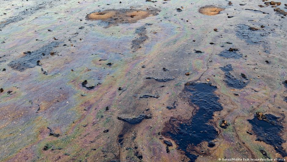
Satellite imagery indicates that oil pollution is spreading through parts of the Strait of Hormuz as attacks on shipping continue during the war involving the United States and Iran. Greenpeace said it has tracked more than 100 spills since the conflict began, although GPS spoofing and limited reporting from the region make the full extent difficult to determine.
The environmental organization identified five major slicks with a combined visible area of about 240 square kilometers earlier this week. More recent images showed roughly 80 square kilometers of surface oil, a reduction Greenpeace environmental disaster relief expert Nina Noelle attributed partly to weather conditions dispersing the slicks. She cautioned that smaller surface patches do not necessarily mean reduced ecological damage, because oil can sink into sediment and affect ecosystems for years.
One slick was detected near Oman's Musandam National Park, which contains coral reefs, marine life and seabird breeding grounds. Another was found near Iran's Minab River Delta, including protected mudflats and mangrove forests. Noelle said oil can coat mangrove roots, obstructing gas exchange and potentially killing the trees, while seabirds exposed to oil can lose waterproofing and buoyancy. Oil can also damage eggs and affect their development.
A Russian tanker carrying about 800,000 barrels of oil stranded off Oman in June, causing what the report described as a major spill. Greenpeace also said as many as 85 large oil-carrying tankers were stuck in the strait earlier in the war; 13 remained, according to the organization. Each vessel represents a potential spill risk if attacked or otherwise damaged.
The pollution may also threaten coastal communities and water supplies. Fish exposed to oil can die, while Gulf states depend heavily on desalination: the source says desalination supplies 90% of drinking water in Kuwait, about 86% in Oman and 70% in Saudi Arabia. Environmental researcher Wim Zwijnenburg of the Dutch peace organization Pax said military activity, mines and restricted access make rapid cleanup difficult.
Greenpeace is using publicly available imagery from the European Union's Copernicus Sentinel satellites, while access to some higher-resolution commercial imagery has been limited during the war. Noelle described the group's estimate as conservative and said the situation could be worse. She also argued that reducing dependence on oil and gas would provide the strongest long-term way to limit similar environmental risks.