Satellite images show Manitoba farmland changing through 2026 growing season
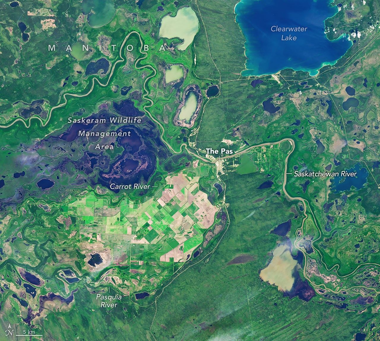
NASA satellite imagery tracks the shift from green crops to harvested and brown fields in Manitoba’s northernmost farming area. The Carrot River Valley covers more than 40,000 hectares amid wetlands, where agriculture depends on dikes and pumping to manage flood risks.
Satellite images from NASA show how farmland in Manitoba’s Carrot River Valley changed during the 2026 growing season. The images, captured on July 2 and September 21 by Landsat 9 and Landsat 8, show fields west of The Pas shifting from green crops to predominantly brown land. The area is Manitoba’s northernmost agricultural zone.
The Carrot River Valley, also known as the Pasquia Area Settlement, covers more than 40,000 hectares between the Carrot and Pasquia rivers. It is surrounded by wetlands, including the Saskeram Wildlife Management Area. The Saskatchewan River Delta is generally too wet for extensive farming, but the valley contains a block of straight-edged fields amid channels, lakes and marshes.
In 2025, farmers mainly grew canola and spring wheat, with smaller areas of Canary seed. Planting began later than in areas farther south because of wet conditions. Fertile soil and long summer days at the northern latitude can nevertheless support rapid crop growth.
By September, farmers in the wider Northwest crop reporting region had harvested about 10% of canola and 50% of spring wheat. The Pas recorded only 1.6mm of rain in the previous week, while other parts of the region received as much as 43.9mm. Water management remains central to farming in the valley.
A major flood-control and drainage project began in the 1950s, and modern agriculture continues to rely on dikes and pumping for protection. The imagery contributes to agricultural monitoring using Landsat data.
This independently written report is based on information supplied by the named publisher. Vertrix News has not independently verified the source report.